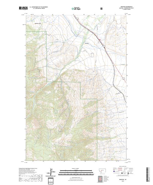
2024 Map of Winston
USGS Topo · Published 2024About this map
Winston sits as the primary settlement on this Broadwater County landscape, where the high peaks of the Elkhorn Mountains meet the valley floor. The map highlights a transition from open ranges and ranching access via Quarter Circle Rd and Galzagorry Rd to the protected timberlands of the Helena National Forest. A complex drainage system defines the local geography, with Beaver Creek and its many tributaries, including South Fork Beaver Creek, carving through the gulches. High-altitude landmarks like Graham Spring and Kelley Spring provide critical water points in the drier upland reaches. The presence of routes such as Pole Creek Trl and Beaver Creek Trl suggests a landscape utilized for both forest management and recreation, while the scattered settlement at Spokane Creek marks the northern extent of this mountain-fringed territory.
Find a feature on this map
33 named features on this map. Tap any name to fly to it.
Don’t see what you’re looking for? This feature index may not catch every label — zoom into the map to look around manually.
Map Details
Editions of this 2024 Winston Map
This is the sole edition of this map. No revisions or reprints were ever made.
Other maps of this area

1886 · Fort Logan
USGS Topo · 1:250,000

1948 · White Sulphur Springs
USGS Topo · 1:250,000

1950 · Canyon Ferry
USGS Topo · 1:62,500

1950 · Townsend
USGS Topo · 1:62,500

1950 · East Helena
USGS Topo · 1:62,500

1950 · Clancy
USGS Topo · 1:62,500

1958 · White Sulphur Springs
USGS Topo · 1:250,000

1961 · White Sulphur Springs
USGS Topo · 1:250,000

1965 · White Sulphur Springs
USGS Topo · 1:250,000
1972 · Canyon Ferry SW
USGS Topo · 1:24,000