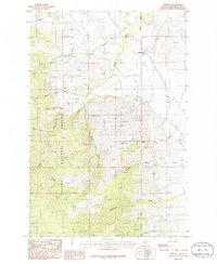
1986 Map of Winston
USGS Topo · Published 1986About this map
Winston sits at the eastern edge of this landscape, positioned along the Burlington Northern railroad corridor. The area transitions quickly from the rail-side settlement into the high, spring-fed drainages of the Helena National Forest. Numerous small-scale industrial markers such as a Mine Shaft and various Gravel Pit locations suggest a history of resource extraction tied to the geology of the Elkhorn Mountains foothills.
Find a feature on this map
21 named features on this map. Tap any name to fly to it.
Don’t see what you’re looking for? This feature index may not catch every label — zoom into the map to look around manually.
Map Details
Editions of this 1986 Winston Map
This is the sole edition of this map. No revisions or reprints were ever made.
Other maps of this area

1886 · Fort Logan
USGS Topo · 1:250,000

1948 · White Sulphur Springs
USGS Topo · 1:250,000

1950 · Canyon Ferry
USGS Topo · 1:62,500

1950 · Townsend
USGS Topo · 1:62,500

1950 · East Helena
USGS Topo · 1:62,500

1950 · Clancy
USGS Topo · 1:62,500

1958 · White Sulphur Springs
USGS Topo · 1:250,000

1961 · White Sulphur Springs
USGS Topo · 1:250,000

1965 · White Sulphur Springs
USGS Topo · 1:250,000
1972 · Canyon Ferry SW
USGS Topo · 1:24,000