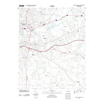
2010 Map of Winston-Salem East
USGS Topo · Published 2010About this map
Winston-Salem and its eastern suburbs are shown in a period of dense residential and commercial development during the early 21st century. The map highlights the historic core of Old Salem alongside major institutional hubs like Winston-Salem State University in Columbia Heights. The landscape is a mix of established neighborhoods such as Waughtown, Skyview Park, and East Winston, and newer developments like Four Seasons and Rolling Acres. A significant recreational and utility corridor centers on Salem Lake and the Salem Lake Dam, surrounded by the Winston Lake Golf Course and Oaklawn Memorial Gardens. Industrial activity is localized at the Piedmont Quarry, while local aviation history is preserved at Blevins Airport. The terrain is characterized by the watershed of Salem Creek and the South Fork Muddy Creek, which provide a natural structure to the increasingly suburbanized landscape of Forsyth County.
Find a feature on this map
95 named features on this map. Tap any name to fly to it.
Don’t see what you’re looking for? This feature index may not catch every label — zoom into the map to look around manually.
Map Details
Editions of this 2010 Winston-Salem East Map
This is the sole edition of this map. No revisions or reprints were ever made.
Other maps of this area

1949 · Eller
USGS Topo · 1:24,000

1949 · High Point West
USGS Topo · 1:24,000

1950 · Winston-Salem West
USGS Topo · 1:24,000

1950 · Winston-Salem East
USGS Topo · 1:24,000

1951 · Winston-Salem West
USGS Topo · 1:24,000

1951 · Winston-Salem East
USGS Topo · 1:24,000

1951 · Rural Hall
USGS Topo · 1:24,000

1951 · Walkertown
USGS Topo · 1:24,000

1953 · Charlotte
USGS Topo · 1:250,000

1953 · Winston-Salem
USGS Topo · 1:250,000