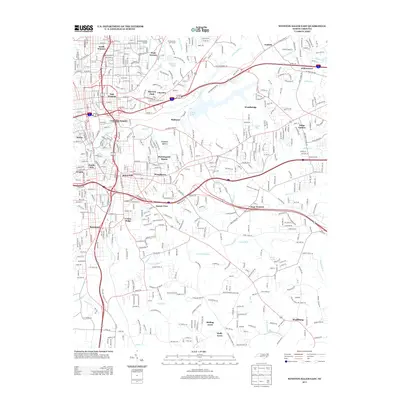
2013 Map of Winston-Salem East
USGS Topo · Published 2013About this map
Salem Lake and the industrial activity at Piedmont Quarry anchor this 2013 survey of the eastern half of North Carolina's Twin City area. The map documents a complex suburban and industrial landscape where long-established neighborhoods like Waughtown and East Winston meet more recent residential developments such as Rolling Acres and Holly Acres. The drainage patterns of the S Fork Muddy Cr and Brushy Fork define the terrain, carving through the residential blocks of Sunnyside and Arcadia.
Find a feature on this map
51 named features on this map. Tap any name to fly to it.
Don’t see what you’re looking for? This feature index may not catch every label — zoom into the map to look around manually.
Map Details
Editions of this 2013 Winston-Salem East Map
This is the sole edition of this map. No revisions or reprints were ever made.
Other maps of this area

1949 · Eller
USGS Topo · 1:24,000

1949 · High Point West
USGS Topo · 1:24,000

1950 · Winston-Salem West
USGS Topo · 1:24,000

1950 · Winston-Salem East
USGS Topo · 1:24,000

1951 · Winston-Salem West
USGS Topo · 1:24,000

1951 · Winston-Salem East
USGS Topo · 1:24,000

1951 · Rural Hall
USGS Topo · 1:24,000

1951 · Walkertown
USGS Topo · 1:24,000

1953 · Charlotte
USGS Topo · 1:250,000

1953 · Winston-Salem
USGS Topo · 1:250,000