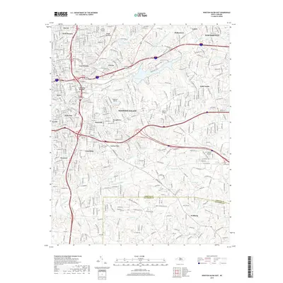
2019 Map of Winston-Salem East
USGS Topo · Published 2019About this map
Winston-Salem serves as the focal point of this 2019 survey, illustrating the dense urban and suburban development of eastern Forsyth County. Neighborhoods like Columbia Heights, East Winston, and Sunnyside show a tightly knit residential grid, while the presence of the Smith Reynolds Airport and Piedmont Quarry highlights the area's industrial and infrastructure hubs. The landscape is marked by numerous historic resting places, including Evergreen Cem and Bellevue Cem, which offer significant value for genealogical research in these established communities.
Find a feature on this map
50 named features on this map. Tap any name to fly to it.
Don’t see what you’re looking for? This feature index may not catch every label — zoom into the map to look around manually.
Map Details
Editions of this 2019 Winston-Salem East Map
This is the sole edition of this map. No revisions or reprints were ever made.
Other maps of this area

1949 · Eller
USGS Topo · 1:24,000

1949 · High Point West
USGS Topo · 1:24,000

1950 · Winston-Salem West
USGS Topo · 1:24,000

1950 · Winston-Salem East
USGS Topo · 1:24,000

1951 · Winston-Salem West
USGS Topo · 1:24,000

1951 · Winston-Salem East
USGS Topo · 1:24,000

1951 · Rural Hall
USGS Topo · 1:24,000

1951 · Walkertown
USGS Topo · 1:24,000

1953 · Charlotte
USGS Topo · 1:250,000

1953 · Winston-Salem
USGS Topo · 1:250,000