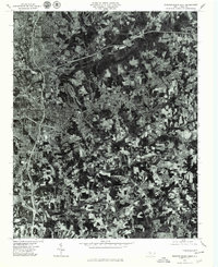
1977 Map of Winston-Salem East
USGS Topo · Published 1979About this map
Winston-Salem dominates the western portion of this 1977 orthophoto quadrangle, showing the intensive urban and industrial development that defined the city in the late twentieth century. This photographic record, prepared by the United States Department of the Interior Geological Survey, captures the expansion of suburban residential patterns into the surrounding landscape. To the east, the sprawling waters of Salem Lake provide a sharp contrast to the dense network of surface streets and interstate interchanges. Smaller community hubs such as Sunnyside, Union Ridge, and Rosemont appear integrated into the growing metropolitan fabric. On the southeastern edge, the settlement of Wallburg remains more distinct, surrounded by a mosaic of cleared agricultural fields and woodlots that characterize the transition from the city core to the North Carolina Piedmont countryside.
Find a feature on this map
6 named features on this map. Tap any name to fly to it.
Don’t see what you’re looking for? This feature index may not catch every label — zoom into the map to look around manually.
Map Details
Editions of this 1977 Winston-Salem East Map
This is the sole edition of this map. No revisions or reprints were ever made.
Other maps of this area

1949 · Eller
USGS Topo · 1:24,000

1949 · High Point West
USGS Topo · 1:24,000

1950 · Winston-Salem West
USGS Topo · 1:24,000

1950 · Winston-Salem East
USGS Topo · 1:24,000

1951 · Winston-Salem West
USGS Topo · 1:24,000

1951 · Winston-Salem East
USGS Topo · 1:24,000

1951 · Rural Hall
USGS Topo · 1:24,000

1951 · Walkertown
USGS Topo · 1:24,000

1953 · Charlotte
USGS Topo · 1:250,000

1953 · Winston-Salem
USGS Topo · 1:250,000