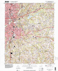
1997 Map of Winston-Salem East
USGS Topo · Published 2001About this map
Winston-Salem anchors the northwestern quadrant of this map, revealing the dense urban development of neighborhoods like East Winston and Columbia Heights as they transition into the surrounding North Carolina countryside. Educational and civic infrastructure is a dominant theme, marked by the campuses of Salem College and Winston-Salem University, alongside athletic landmarks like Bowman Gray Stadium. The map provides a look at the city's growth along the Norfolk And Western railroad and major modern thoroughfares like Interchange 193.
Find a feature on this map
60 named features on this map. Tap any name to fly to it.
Don’t see what you’re looking for? This feature index may not catch every label — zoom into the map to look around manually.
Map Details
Editions of this 1997 Winston-Salem East Map
This is the sole edition of this map. No revisions or reprints were ever made.
Other maps of this area

1949 · Eller
USGS Topo · 1:24,000

1949 · High Point West
USGS Topo · 1:24,000

1950 · Winston-Salem West
USGS Topo · 1:24,000

1950 · Winston-Salem East
USGS Topo · 1:24,000

1951 · Winston-Salem West
USGS Topo · 1:24,000

1951 · Winston-Salem East
USGS Topo · 1:24,000

1951 · Rural Hall
USGS Topo · 1:24,000

1951 · Walkertown
USGS Topo · 1:24,000

1953 · Charlotte
USGS Topo · 1:250,000

1953 · Winston-Salem
USGS Topo · 1:250,000