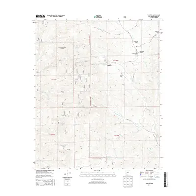
2013 Map of Winston
USGS Topo · Published 2013About this map
Chloride and Winston sit at the eastern edge of the Gila National Forest, serving as gateway settlements to the rugged Black Range of southwestern New Mexico. This survey captures a landscape defined by sharp elevation changes, where seasonal drainages like Mineral Cr and Chloride Cr cut through the terrain. The presence of Santa Niño Cem and the Po in Winston indicates a persistent community identity despite the remote mountain setting.
Find a feature on this map
78 named features on this map. Tap any name to fly to it.
Don’t see what you’re looking for? This feature index may not catch every label — zoom into the map to look around manually.
Map Details
Editions of this 2013 Winston Map
This is the sole edition of this map. No revisions or reprints were ever made.
Other maps of this area

1949 · Lookout Mountain
USGS Topo · 1:62,500

1954 · Tularosa
USGS Topo · 1:250,000

1958 · Tularosa
USGS Topo · 1:250,000

1963 · Thumb Tank Peak
USGS Topo · 1:24,000

1963 · Reeds Peak
USGS Topo · 1:24,000

1963 · Sugarloaf Peak
USGS Topo · 1:24,000

1965 · Winston
USGS Topo · 1:24,000

1965 · Iron Mountain
USGS Topo · 1:24,000

1965 · Jaralosa Mountain
USGS Topo · 1:24,000
1965 · Chise
USGS Topo · 1:24,000