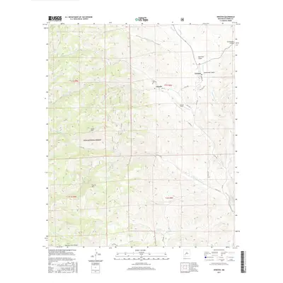
2017 Map of Winston
USGS Topo · Published 2017About this map
The rugged Black Range foothills of Sierra County define this landscape, centered on the historic mining-era settlements of Chloride and Winston. Formerly known as Fairview, Winston sits at the edge of Schoolhouse Canyon, while Chloride remains tucked along the banks of Chloride Cr. Evidence of the area's pioneer heritage is visible at the Santa Niño Cem and along Wall St in Chloride.
Find a feature on this map
40 named features on this map. Tap any name to fly to it.
Don’t see what you’re looking for? This feature index may not catch every label — zoom into the map to look around manually.
Map Details
Editions of this 2017 Winston Map
This is the sole edition of this map. No revisions or reprints were ever made.
Other maps of this area

1949 · Lookout Mountain
USGS Topo · 1:62,500

1954 · Tularosa
USGS Topo · 1:250,000

1958 · Tularosa
USGS Topo · 1:250,000

1963 · Thumb Tank Peak
USGS Topo · 1:24,000

1963 · Reeds Peak
USGS Topo · 1:24,000

1963 · Sugarloaf Peak
USGS Topo · 1:24,000

1965 · Winston
USGS Topo · 1:24,000

1965 · Iron Mountain
USGS Topo · 1:24,000

1965 · Jaralosa Mountain
USGS Topo · 1:24,000
1965 · Chise
USGS Topo · 1:24,000