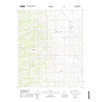
2020 Map of Winston
USGS Topo · Published 2020About this map
Winston and Chloride anchor this corner of Sierra County, reflecting a landscape defined by ranching and old mining traditions. The map reveals a sophisticated network of drainage and terrain, where Mineral Cr and Chloride Cr cut through the foothills of the Gila National Forest. Genealogy researchers can locate the Santa Niño Cem near the banks of the creek, while landmarks like Hagins Peak and Way-Up Mtn dominate the western horizon. Transportation is largely defined by rural county roads like Republic Rd and Miranda Loop, alongside the small Chloride Airport. To the south, the deep relief of Moccasin John Canyon and the threading Dines Trail suggest the transition into more isolated backcountry, where seasonal water sources like Woodhouse Spring and Monument Spring were historically critical for land use.
Find a feature on this map
44 named features on this map. Tap any name to fly to it.
Don’t see what you’re looking for? This feature index may not catch every label — zoom into the map to look around manually.
Map Details
Editions of this 2020 Winston Map
This is the sole edition of this map. No revisions or reprints were ever made.
Other maps of this area

1949 · Lookout Mountain
USGS Topo · 1:62,500

1954 · Tularosa
USGS Topo · 1:250,000

1958 · Tularosa
USGS Topo · 1:250,000

1963 · Thumb Tank Peak
USGS Topo · 1:24,000

1963 · Reeds Peak
USGS Topo · 1:24,000

1963 · Sugarloaf Peak
USGS Topo · 1:24,000

1965 · Winston
USGS Topo · 1:24,000

1965 · Iron Mountain
USGS Topo · 1:24,000

1965 · Jaralosa Mountain
USGS Topo · 1:24,000
1965 · Chise
USGS Topo · 1:24,000