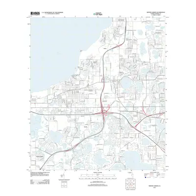
2012 Map of Winter Garden
USGS Topo · Published 2012About this map
Lake Apopka anchors the northwest corner of this 2012 survey, defining the shoreline and hydrology of the surrounding citrus-growing and suburban landscape. The map reveals the intricate network of water bodies that characterize this part of Florida, from the large Lake Butler to smaller features like Lake Olympia and Starke Lake. The transportation infrastructure is dominated by the intersection of Florida's Turnpike and major regional arterials, which bypass older settlements such as Fullers, Beulah, and Harlem Heights. For local historians and genealogists, the map provides precise locations for Woodlawn Memorial Park Cem and Ocoee Cem. Aviation interest is represented by Carter Airport and Tilden Groves Airport, while the conversion of rail corridors into recreational space is evident in the West Orange Trail cutting through the residential heart of the quadrangle.
Find a feature on this map
55 named features on this map. Tap any name to fly to it.
Don’t see what you’re looking for? This feature index may not catch every label — zoom into the map to look around manually.
Map Details
Editions of this 2012 Winter Garden Map
This is the sole edition of this map. No revisions or reprints were ever made.
Other maps of this area

1953 · Lake Jessamine
USGS Topo · 1:24,000

1953 · Windermere
USGS Topo · 1:24,000

1955 · Orlando
USGS Topo · 1:250,000

1956 · Winter Garden
USGS Topo · 1:24,000

1956 · Orlando West
USGS Topo · 1:24,000

1957 · Orlando
USGS Topo · 1:250,000

1958 · Orlando
USGS Topo · 1:250,000

1959 · Lake Louisa
USGS Topo · 1:24,000

1959 · Forest City
USGS Topo · 1:24,000

1960 · Apopka
USGS Topo · 1:24,000