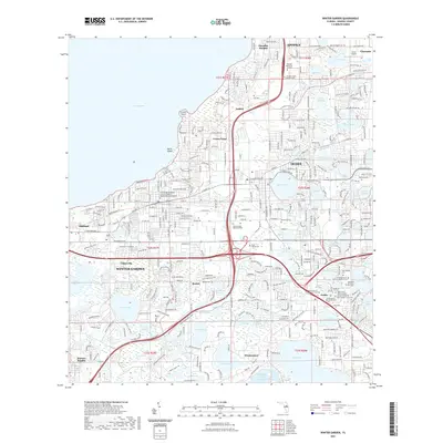
2021 Map of Winter Garden
USGS Topo · Published 2021About this map
Lake Apopka anchors the northwestern corner of this Orange County landscape, where the transition from agriculture to suburban density is marked by a high concentration of memorial sites and family burial grounds. The map documents the established communities of Winter Garden, Ocoee, and Gotha, alongside smaller settlements like Tildenville and Beulah. The presence of specialized sites such as the Orange County Paupers Cem and the Dann Family Cem provides significant data for genealogists, while the Nwwrf Equestrian Trl and West Orange Trl show the modern repurposing of the terrain. The eastern portion of the survey is dominated by a dense network of water bodies, including Starke Lake and Lake Florence, reflecting the region's characteristic karst topography and water-integrated town planning.
Find a feature on this map
76 named features on this map. Tap any name to fly to it.
Don’t see what you’re looking for? This feature index may not catch every label — zoom into the map to look around manually.
Map Details
Editions of this 2021 Winter Garden Map
This is the sole edition of this map. No revisions or reprints were ever made.
Other maps of this area

1953 · Lake Jessamine
USGS Topo · 1:24,000

1953 · Windermere
USGS Topo · 1:24,000

1955 · Orlando
USGS Topo · 1:250,000

1956 · Winter Garden
USGS Topo · 1:24,000

1956 · Orlando West
USGS Topo · 1:24,000

1957 · Orlando
USGS Topo · 1:250,000

1958 · Orlando
USGS Topo · 1:250,000

1959 · Lake Louisa
USGS Topo · 1:24,000

1959 · Forest City
USGS Topo · 1:24,000

1960 · Apopka
USGS Topo · 1:24,000