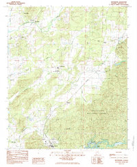
1984 Map of Winterboro
USGS Topo · Published 1985About this map
Talladega Creek and its many tributaries, including Greasy Creek and Weewoka Creek, define the topography of this central Alabama landscape during the early 1980s. The region is characterized by a mix of agricultural valley lands and the dense wooded terrain of the Talladega National Forest in the southeast. Transportation and commerce are centered on the corridors of the Southern and Seaboard railroads, which connect established communities like Winterboro, Alpine, and Sycamore.
Find a feature on this map
34 named features on this map. Tap any name to fly to it.
Don’t see what you’re looking for? This feature index may not catch every label — zoom into the map to look around manually.
Map Details
Editions of this 1984 Winterboro Map
This is the sole edition of this map. No revisions or reprints were ever made.
Other maps of this area

1890 · Talladega
USGS Topo · 1:125,000

1892 · Talladega
USGS Topo · 1:125,000

1915 · Gantts Quarry
USGS Topo · 1:48,000

1917 · Gantts Quarry
USGS Topo · 1:62,500

1943 · Talladega
USGS Topo · 1:62,500

1944 · Goodwater
USGS Topo · 1:62,500

1946 · Talladega
USGS Topo · 1:62,500

1947 · Goodwater
USGS Topo · 1:62,500

1951 · Laniers
USGS Topo · 1:24,000

1953 · Birmingham
USGS Topo · 1:250,000