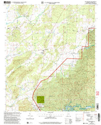
2001 Map of Winterboro
USGS Topo · Published 2004About this map
Talladega Creek and its diverse tributaries define this central Alabama landscape, where the northern expanse of the Talladega National Forest meets a network of established settlements. Small communities like Winterboro and Sycamore serve as focal points along the transportation corridors, while rural life is anchored by local institutions such as the Pittard Vocational Sch and several country churches, including Mt Olive Ch and Tallaseehatchee Ch. The terrain transitions from the forest highlands down toward the creek valleys, marked by features like Oxbow Bend and the winding Weewoka Creek. For those researching local roots, the map provides precise locations for older centers of activity like Plantersville, Nottingham, and Alpine, alongside various unnamed cemeteries and small landmarks like the Riser Chapel Ch situated near the western edge of the survey.
Find a feature on this map
35 named features on this map. Tap any name to fly to it.
Don’t see what you’re looking for? This feature index may not catch every label — zoom into the map to look around manually.
Map Details
Editions of this 2001 Winterboro Map
This is the sole edition of this map. No revisions or reprints were ever made.
Other maps of this area

1890 · Talladega
USGS Topo · 1:125,000

1892 · Talladega
USGS Topo · 1:125,000

1915 · Gantts Quarry
USGS Topo · 1:48,000

1917 · Gantts Quarry
USGS Topo · 1:62,500

1943 · Talladega
USGS Topo · 1:62,500

1944 · Goodwater
USGS Topo · 1:62,500

1946 · Talladega
USGS Topo · 1:62,500

1947 · Goodwater
USGS Topo · 1:62,500

1951 · Laniers
USGS Topo · 1:24,000

1953 · Birmingham
USGS Topo · 1:250,000