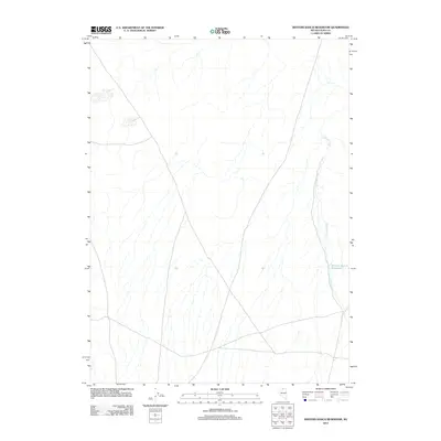
2012 Map of Winters Ranch Reservoir
USGS Topo · Published 2012About this map
Winters Ranch Reservoir serves as a critical focal point for water management in this arid stretch of Elko County. Situated along the course of Chimney Creek, which flows from north to south across the eastern portion of the quadrangle, the reservoir reflects the ranching infrastructure common to the Nevada high desert. The landscape is defined by a network of drainage patterns and intermittent water sources, illustrating the localized scale of water collection necessary for agricultural operations. This 2012 survey by the U.S. Geological Survey documents the sparse but vital development of the region, where the intersection of natural hydrology and man-made reservoirs remains the primary driver of land use and settlement.
Find a feature on this map
2 named features on this map. Tap any name to fly to it.
Don’t see what you’re looking for? This feature index may not catch every label — zoom into the map to look around manually.
Map Details
Editions of this 2012 Winters Ranch Reservoir Map
This is the sole edition of this map. No revisions or reprints were ever made.
Other maps of this area

1955 · McDermitt
USGS Topo · 1:250,000

1959 · McDermitt
USGS Topo · 1:250,000

1973 · McCleary Wells
USGS Topo · 1:24,000

1973 · Corral Lake
USGS Topo · 1:24,000

1973 · Haystack Peak
USGS Topo · 1:24,000

1974 · Soldier Cap
USGS Topo · 1:24,000

1974 · Middle Draw Reservoir
USGS Topo · 1:24,000

1974 · Winters Ranch Reservoir
USGS Topo · 1:24,000

1974 · Burner Hills
USGS Topo · 1:24,000

1974 · Desert Ranch
USGS Topo · 1:24,000