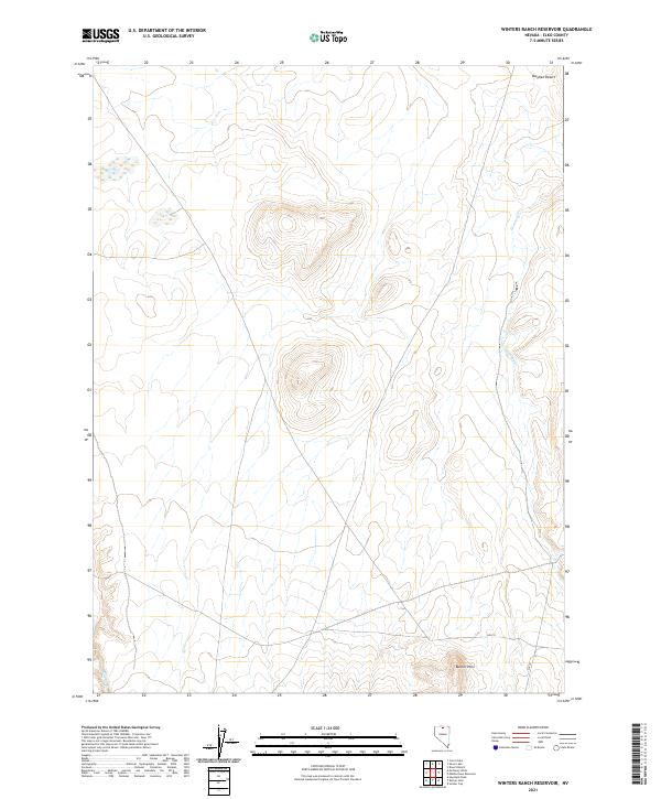
2021 Map of Winters Ranch Reservoir
USGS Topo · Published 2021About this map
Burner Hills anchor the southern portion of this landscape, rising above the arid expanse of the Owyhee Desert in Elko County. This remote basin-and-range terrain is defined by its sparse hydrography, where intermittent drainages like Chimney Cr and Milligan Cr carve through the high desert floor. The map highlights the vastness of the public land survey system, clearly delineating township boundaries such as t43n r47e and t43n r48e.
Find a feature on this map
10 named features on this map. Tap any name to fly to it.
Don’t see what you’re looking for? This feature index may not catch every label — zoom into the map to look around manually.
Map Details
Editions of this 2021 Winters Ranch Reservoir Map
This is the sole edition of this map. No revisions or reprints were ever made.
Other maps of this area

1955 · McDermitt
USGS Topo · 1:250,000

1959 · McDermitt
USGS Topo · 1:250,000

1973 · McCleary Wells
USGS Topo · 1:24,000

1973 · Corral Lake
USGS Topo · 1:24,000

1973 · Haystack Peak
USGS Topo · 1:24,000

1974 · Soldier Cap
USGS Topo · 1:24,000

1974 · Middle Draw Reservoir
USGS Topo · 1:24,000

1974 · Winters Ranch Reservoir
USGS Topo · 1:24,000

1974 · Burner Hills
USGS Topo · 1:24,000

1974 · Desert Ranch
USGS Topo · 1:24,000