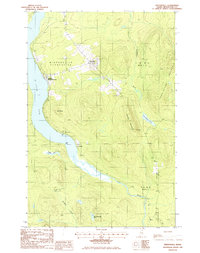
1985 Map of Winterville
USGS Topo · Published 1986About this map
Winterville Plantation serves as the focal point for this 1980s landscape in Northern Maine, where the Canadian Pacific railroad tracks trace the eastern shore of St Froid Lake. Small settlement clusters like Quimby (Winterville Sta) and McNally suggest a community historically tied to the timber and transit routes of the North Woods. The terrain is defined by significant elevations, including Pennington Mountain and Hedgehog Mountain, which dominate the eastern half of the quadrangle.
Find a feature on this map
24 named features on this map. Tap any name to fly to it.
Don’t see what you’re looking for? This feature index may not catch every label — zoom into the map to look around manually.
Map Details
Editions of this 1985 Winterville Map
This is the sole edition of this map. No revisions or reprints were ever made.
Other maps of this area

1927 · Square Lake
USGS Topo · 1:48,000

1928 · Eagle Lake
USGS Topo · 1:48,000

1928 · Winterville
USGS Topo · 1:48,000

1929 · Portage
USGS Topo · 1:62,500

1931 · Square Lake
USGS Topo · 1:62,500

1931 · Eagle Lake
USGS Topo · 1:62,500

1931 · Portage
USGS Topo · 1:62,500

1931 · Winterville
USGS Topo · 1:62,500

1953 · Square Lake
USGS Topo · 1:62,500

1953 · Portage
USGS Topo · 1:62,500
Featured Places
- Winterville Plantation, ME
- Nixon, T14 R6 WELS
- T15 R6 WELS, ME
- Quimby, Winterville Plantation
- McNally, T14 R7 WELS