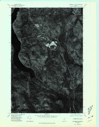
1975 Map of Winterville NE
USGS Topo · Published 1981About this map
Winterville and Quimby stand as the primary settlements in this northern Maine landscape, captured during a 1975 aerial survey. The orthophoto reveals a distinct pattern of cleared agricultural plots and rural homesteads concentrated along the western edge, contrasting sharply with the deep forest cover that dominates the eastern half of the quadrangle. The hydrology of the region is defined by the expansive St Froid Lake and the winding course of the Fish River, which cuts through the southern portion of the sheet. Smaller water features like Pennington Pond and Mc Nally Brook further illustrate the drainage patterns of this timber-rich territory. The map provides a literal photographic record of land use, showing the exact footprint of forest clearing and road development at the mid-1970s.
Find a feature on this map
6 named features on this map. Tap any name to fly to it.
Don’t see what you’re looking for? This feature index may not catch every label — zoom into the map to look around manually.
Map Details
Editions of this 1975 Winterville NE Map
This is the sole edition of this map. No revisions or reprints were ever made.
Other maps of this area

1927 · Square Lake
USGS Topo · 1:48,000

1928 · Eagle Lake
USGS Topo · 1:48,000

1928 · Winterville
USGS Topo · 1:48,000

1929 · Portage
USGS Topo · 1:62,500

1931 · Square Lake
USGS Topo · 1:62,500

1931 · Eagle Lake
USGS Topo · 1:62,500

1931 · Portage
USGS Topo · 1:62,500

1931 · Winterville
USGS Topo · 1:62,500

1953 · Square Lake
USGS Topo · 1:62,500

1953 · Portage
USGS Topo · 1:62,500
Featured Places
- Winterville Plantation, ME
- Nixon, T14 R6 WELS
- T15 R6 WELS, ME
- Quimby, Winterville Plantation
- McNally, T14 R7 WELS