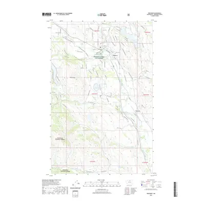
2020 Map of Winthrop
USGS Topo · Published 2020About this map
The confluence of the Methow River and Chewuch River serves as the focal point for Winthrop, a valley community where irrigation and conservation define the landscape. This modern survey illustrates the extensive water management systems essential to the region, including the Chewuch Canal and the Winthrop National Fish Hatchery. The rugged topography surrounding the town is dominated by Patterson Mtn and Signal Hill, while numerous small water bodies like Pearrygin Lake, Big Twin Lake, and Barnsley Lake punctuate the basin.
Find a feature on this map
103 named features on this map. Tap any name to fly to it.
Don’t see what you’re looking for? This feature index may not catch every label — zoom into the map to look around manually.
Map Details
Editions of this 2020 Winthrop Map
This is the sole edition of this map. No revisions or reprints were ever made.
Other maps of this area

1899 · Methow
USGS Topo · 1:125,000

1901 · Methow
USGS Topo · 1:125,000

1955 · Concrete
USGS Topo · 1:250,000

1958 · Concrete
USGS Topo · 1:250,000

1962 · Concrete
USGS Topo · 1:250,000

1962 · Mazama
USGS Topo · 1:62,500

1963 · Doe Mountain
USGS Topo · 1:62,500
1969 · Thompson Ridge
USGS Topo · 1:24,000
1969 · Buttermilk Butte
USGS Topo · 1:62,500
1969 · Twisp West
USGS Topo · 1:24,000