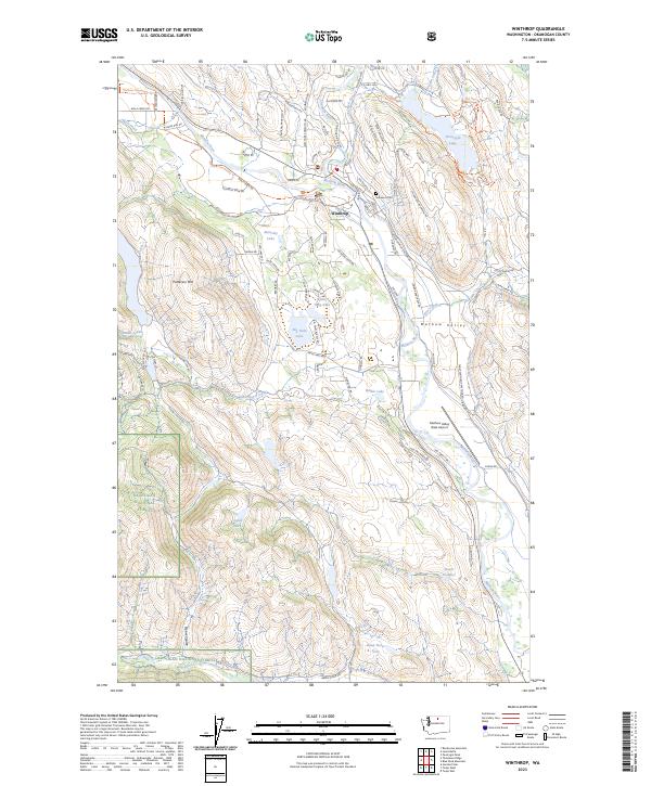
2023 Map of Winthrop
USGS Topo · Published 2023About this map
The Methow River and Chewuch River converge at the heart of Winthrop, a valley community where historical irrigation and modern conservation meet. This 2023 survey illustrates a landscape managed for both wildlife and recreation, anchored by the Winthrop National Fish Hatchery and the vast Okanogan National Forest to the west. The layout of the Methow Valley is defined by its water, from the industrial-era Chewuch Canal to the numerous high-country lakes like Big Twin Lake and Dead Horse Lake.
Find a feature on this map
102 named features on this map. Tap any name to fly to it.
Don’t see what you’re looking for? This feature index may not catch every label — zoom into the map to look around manually.
Map Details
Editions of this 2023 Winthrop Map
This is the sole edition of this map. No revisions or reprints were ever made.
Other maps of this area

1899 · Methow
USGS Topo · 1:125,000

1901 · Methow
USGS Topo · 1:125,000

1955 · Concrete
USGS Topo · 1:250,000

1958 · Concrete
USGS Topo · 1:250,000

1962 · Concrete
USGS Topo · 1:250,000

1962 · Mazama
USGS Topo · 1:62,500

1963 · Doe Mountain
USGS Topo · 1:62,500
1969 · Thompson Ridge
USGS Topo · 1:24,000
1969 · Buttermilk Butte
USGS Topo · 1:62,500
1969 · Twisp West
USGS Topo · 1:24,000