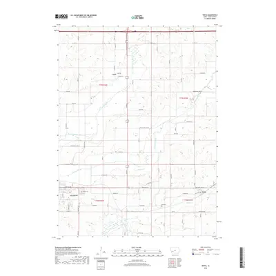
2018 Map of Wiota
USGS Topo · Published 2018About this map
The E Nishnabotna River meanders through the western Cass County landscape, anchoring a region defined by its fertile valleys and established rural communities. This survey documents the area between Atlantic and Wiota, showing the intricate network of section-line roads and named routes like White Pole Rd and Hamburg Rd. The settlement of Lorah serves as a northern waypoint, positioned near the headwaters of drainage systems like Troublesome Creek. For those researching local heritage, the map identifies essential community markers including the Lorah Cem, Atlantic Cem, and Wiota Cem. The terrain is deeply etched by waterways such as Turkey Cr and Jim Br, which dictate the placement of farmsteads and transport corridors across the township boundaries of T77N and T76N.
Find a feature on this map
37 named features on this map. Tap any name to fly to it.
Don’t see what you’re looking for? This feature index may not catch every label — zoom into the map to look around manually.
Map Details
Editions of this 2018 Wiota Map
This is the sole edition of this map. No revisions or reprints were ever made.
Other maps of this area

1954 · Omaha
USGS Topo · 1:250,000

1957 · Omaha
USGS Topo · 1:250,000

1957 · Audubon
USGS Topo · 1:62,500

1958 · Omaha
USGS Topo · 1:250,000

1971 · Anita
USGS Topo · 1:24,000

1971 · Wiota
USGS Topo · 1:24,000

1971 · Atlantic
USGS Topo · 1:24,000

1971 · Anita SW
USGS Topo · 1:24,000

1971 · Lewis
USGS Topo · 1:24,000

1971 · Massena
USGS Topo · 1:24,000