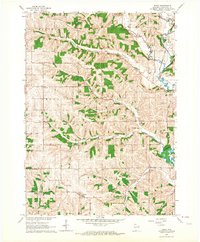
1962 Map of Wiota
USGS Topo · Published 1964About this map
The Pecatonica River and its numerous tributaries, including Mud Branch and Whiteside Creek, carve through the Lafayette County landscape in this early 1960s survey. This era shows a rural township structure defined by small community hubs like Wiota and Lamont, each supported by localized institutions. Genealogists will find a dense network of family-named landmarks and rural infrastructure, from the Andrews Cem and Miller Cem to the one-room schoolhouses of a passing era, such as Hawley Sch and Everson Sch. The northeast corner is marked by the Yellowstone Conservation Area, while industrial activity is noted through scattered Quarries. The Illinois Central Railroad skirts the eastern edge near Argyle, highlighting the importance of rail transport to these agricultural communities before the modernization of the state highway system fully took hold.
Find a feature on this map
33 named features on this map. Tap any name to fly to it.
Don’t see what you’re looking for? This feature index may not catch every label — zoom into the map to look around manually.
Map Details
Editions of this 1962 Wiota Map
2 editions found
Other maps of this area

1902 · Mineral Point
USGS Topo · 1:125,000

1923 · Blanchardville
USGS Topo · 1:62,500

1923 · South Wayne
USGS Topo · 1:62,500

1954 · Rockford
USGS Topo · 1:250,000

1955 · Rockford
USGS Topo · 1:250,000

1958 · Rockford
USGS Topo · 1:250,000

1959 · Dubuque
USGS Topo · 1:250,000

1961 · Dubuque
USGS Topo · 1:250,000

1962 · Dubuque
USGS Topo · 1:250,000
1962 · Blanchardville
USGS Topo · 1:62,500