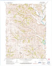
1962 Map of Wiota
USGS Topo · Published 1992About this map
Wiota and the surrounding townships of Lamont, Argyle, and Fayette are defined by a complex network of waterways feeding the E Br Pecatonica R. In the early 1960s, this rural landscape was dotted with local landmarks significant to genealogists, including the Andrews Cem, Miller Cem, and the uniquely combined Cherry Branch Sch Cem. The topography is shaped by the winding paths of Whiteside Creek and Apple Branch, which carve through the Lafayette County terrain.
Find a feature on this map
33 named features on this map. Tap any name to fly to it.
Don’t see what you’re looking for? This feature index may not catch every label — zoom into the map to look around manually.
Map Details
Editions of this 1962 Wiota Map
2 editions found
Other maps of this area

1902 · Mineral Point
USGS Topo · 1:125,000

1923 · Blanchardville
USGS Topo · 1:62,500

1923 · South Wayne
USGS Topo · 1:62,500

1954 · Rockford
USGS Topo · 1:250,000

1955 · Rockford
USGS Topo · 1:250,000

1958 · Rockford
USGS Topo · 1:250,000

1959 · Dubuque
USGS Topo · 1:250,000

1961 · Dubuque
USGS Topo · 1:250,000

1962 · Dubuque
USGS Topo · 1:250,000
1962 · Blanchardville
USGS Topo · 1:62,500