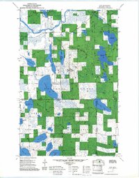
1970 Map of Wirt
USGS Topo · Published 1973About this map
The Big Fork River meanders through the northern reaches of this landscape, anchoring the small settlement of Wirt. This territory is defined by the overlapping boundaries of the Chippewa National Forest and the Leech Lake Indian Reservation, showing a complex system of resource management and land use. Water dominates the geography, with large bodies like Whitefish Lake and Sand Lake providing significant landmarks for local navigation and recreation.
Find a feature on this map
43 named features on this map. Tap any name to fly to it.
Don’t see what you’re looking for? This feature index may not catch every label — zoom into the map to look around manually.
Map Details
Editions of this 1970 Wirt Map
2 editions found
Other maps of this area

1918 · Zora
USGS Topo · 1:62,500

1919 · Zora
USGS Topo · 1:62,500

1919 · Gemmell
USGS Topo · 1:62,500

1919 · Max
USGS Topo · 1:62,500

1954 · Bemidji
USGS Topo · 1:250,000

1954 · Hibbing
USGS Topo · 1:250,000

1957 · Bemidji
USGS Topo · 1:250,000

1957 · Hibbing
USGS Topo · 1:250,000

1958 · Bemidji
USGS Topo · 1:250,000

1958 · Hibbing
USGS Topo · 1:250,000