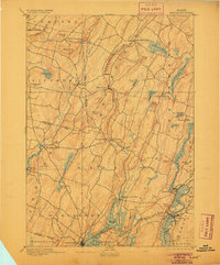
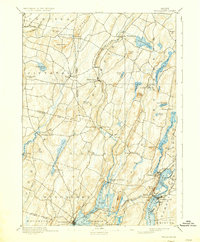
1893 Map of Wiscasset
USGS Topo · Published 1905About this map
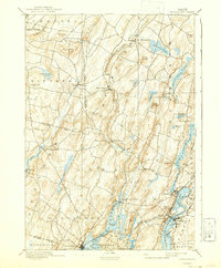
Wiscasset and the tidal reaches of the Shepscot River anchor this late 19th-century survey of coastal Maine. The landscape is defined by the heavy reliance on waterway transport and the emerging rail network of the Central Railroad, which connects Newcastle to Damariscotta Mills. This era captures the region before modern highway expansion, where inland villages like Head Tide, Alna, and Dresden Mills served as local hubs for timber and agriculture. Numerous ponds and streams, such as Dyer Long Pond and Togus Stream, carve through a terrain dotted with named high points like Telegraph Hill and Blinn Hill. The map also details the maritime geography of the Damariscotta River and the complex shoreline around Lehman Island and Cunningham Pt., reflecting a period when the river-and-rail economy was the lifeblood of Lincoln County.
Find a feature on this map
74 named features on this map. Tap any name to fly to it.
Don’t see what you’re looking for? This feature index may not catch every label — zoom into the map to look around manually.
Map Details
Editions of this 1893 Wiscasset Map
7 editions found
Other maps of this area

1892 · Gardiner
USGS Topo · 1:62,500

1892 · Augusta
USGS Topo · 1:62,500

1893 · Vassalboro
USGS Topo · 1:62,500

1893 · Wiscasset
USGS Topo · 1:62,500

1893 · Boothbay
USGS Topo · 1:62,500

1894 · Bath
USGS Topo · 1:62,500

1898 · Vassalboro
USGS Topo · 1:62,500

1904 · Monhegan
USGS Topo · 1:62,500

1906 · Monhegan
USGS Topo · 1:62,500

1913 · Waldoboro
USGS Topo · 1:48,000