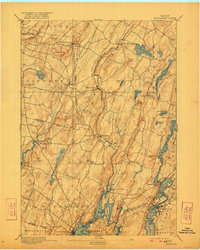
1893 Map of Wiscasset
USGS Topo · Published 1921About this map
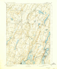
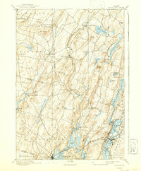
The Sheepscot River and its tidal estuaries dominate this 1891 survey, reflecting a coastal Maine landscape deeply integrated with the water. Early settlements such as Head Tide, Alna, and Dresden Mills are depicted alongside the inland agricultural hubs of North Pittston and Whitefield. The transport network of the late nineteenth century is visible through the Maine Central Railroad and the Penobscot Shore Line, which facilitated trade and movement across Lincoln and Kennebec counties. Landforms like Joy Ridge and Telegraph Hill provide a glimpse into the topographical challenges faced by early settlers, while numerous ponds, including Pleasant Pond and Deer Meadow Pond, suggest the importance of local water resources. The detailed mapping of small hamlets like South Jefferson and Damariscotta Mills offers researchers a clear view of the region's historical community structure prior to modern suburban development.
Find a feature on this map
65 named features on this map. Tap any name to fly to it.
Don’t see what you’re looking for? This feature index may not catch every label — zoom into the map to look around manually.
Map Details
Editions of this 1893 Wiscasset Map
7 editions found
Other maps of this area

1892 · Gardiner
USGS Topo · 1:62,500

1892 · Augusta
USGS Topo · 1:62,500

1893 · Vassalboro
USGS Topo · 1:62,500

1893 · Wiscasset
USGS Topo · 1:62,500

1893 · Boothbay
USGS Topo · 1:62,500

1894 · Bath
USGS Topo · 1:62,500

1898 · Vassalboro
USGS Topo · 1:62,500

1904 · Monhegan
USGS Topo · 1:62,500

1906 · Monhegan
USGS Topo · 1:62,500

1913 · Waldoboro
USGS Topo · 1:48,000