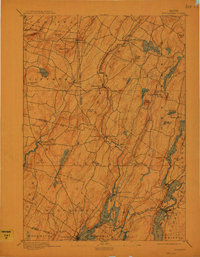
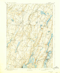
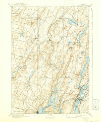
1893 Map of Wiscasset
USGS Topo · Published 1912About this map
The Sheepscot River and Damariscotta River valleys dominate this late-nineteenth-century coastal landscape, where timbered ridges and glacial ponds dictate the layout of early Lincoln County settlements. The Maine Central Railroad hugs the tidal inlets, serving as a vital artery for towns like Wiscasset and Newcastle. Smaller hamlets such as Head Tide and Damariscotta Mills are positioned at narrow river points, hinting at the water-powered industries that once defined these rural communities. Notable elevation points like Telegraph Hill and Williams Hill rise above the complex network of brooks and ponds, including Pleasant Pond and Nehumkeag Pond. The map captures a transitional era where coastal commerce and inland farming relied on a mix of established wagon roads and the growing efficiency of the Penobscot Shore Line.
Find a feature on this map
70 named features on this map. Tap any name to fly to it.
Don’t see what you’re looking for? This feature index may not catch every label — zoom into the map to look around manually.
Map Details
Editions of this 1893 Wiscasset Map
7 editions found
Other maps of this area

1892 · Gardiner
USGS Topo · 1:62,500

1892 · Augusta
USGS Topo · 1:62,500

1893 · Vassalboro
USGS Topo · 1:62,500

1893 · Wiscasset
USGS Topo · 1:62,500

1893 · Boothbay
USGS Topo · 1:62,500

1894 · Bath
USGS Topo · 1:62,500

1898 · Vassalboro
USGS Topo · 1:62,500

1904 · Monhegan
USGS Topo · 1:62,500

1906 · Monhegan
USGS Topo · 1:62,500

1913 · Waldoboro
USGS Topo · 1:48,000