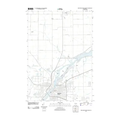
2010 Map of Wisconsin Rapids North
USGS Topo · Published 2010About this map
The Wisconsin River serves as the central artery for this section of Wood County, anchoring the industrial and civic life of Wisconsin Rapids and the village of Biron. This landscape reveals a complex network of water management and river-based development, evidenced by the Biron 2WP71 Dam and the Wisconsin Rapids 2WP44 Dam. Large riverine features such as Big Island, Hunter Island, and Belle Island divide the water's path, while a series of tributary streams including Cranberry Creek and Mosquito Creek drain the surrounding plains.
Find a feature on this map
45 named features on this map. Tap any name to fly to it.
Don’t see what you’re looking for? This feature index may not catch every label — zoom into the map to look around manually.
Map Details
Editions of this 2010 Wisconsin Rapids North Map
This is the sole edition of this map. No revisions or reprints were ever made.
Other maps of this area

1955 · Green Bay
USGS Topo · 1:250,000

1956 · Milladore
USGS Topo · 1:48,000

1956 · Stevens Point
USGS Topo · 1:48,000

1957 · Wisconsin Rapids
USGS Topo · 1:48,000

1957 · Whiting
USGS Topo · 1:48,000

1967 · Wisconsin Rapids
USGS Topo · 1:62,500

1970 · Kellner
USGS Topo · 1:24,000

1970 · Junction City
USGS Topo · 1:24,000
1970 · Sherry
USGS Topo · 1:24,000
1970 · Rocky Run
USGS Topo · 1:24,000