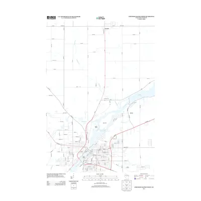
2013 Map of Wisconsin Rapids North
USGS Topo · Published 2013About this map
Wisconsin River hydraulics define the landscape north of the city, where the river widens into the Biron Flowage and the Wisconsin Rapids Flowage 5391. These managed waters are punctuated by significant landforms like Big Island, Hunter Island, and Belle Island, which shape the flow through the heart of the region. The settlement of Biron sits along the eastern bank, while Rudolph anchors the northern reaches of the quadrangle.
Find a feature on this map
146 named features on this map. Tap any name to fly to it.
Don’t see what you’re looking for? This feature index may not catch every label — zoom into the map to look around manually.
Map Details
Editions of this 2013 Wisconsin Rapids North Map
This is the sole edition of this map. No revisions or reprints were ever made.
Other maps of this area

1955 · Green Bay
USGS Topo · 1:250,000

1956 · Milladore
USGS Topo · 1:48,000

1956 · Stevens Point
USGS Topo · 1:48,000

1957 · Wisconsin Rapids
USGS Topo · 1:48,000

1957 · Whiting
USGS Topo · 1:48,000

1967 · Wisconsin Rapids
USGS Topo · 1:62,500

1970 · Kellner
USGS Topo · 1:24,000

1970 · Junction City
USGS Topo · 1:24,000
1970 · Sherry
USGS Topo · 1:24,000
1970 · Rocky Run
USGS Topo · 1:24,000