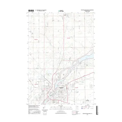
2015 Map of Wisconsin Rapids North
USGS Topo · Published 2015About this map
The Wisconsin River dominates this Wood County landscape, defining the industrial and civic heart of Wisconsin Rapids. Large river features like Big Island and Hunter Island sit just north of the city center, while the Biron Flowage and Wisconsin Rapids Flowage reflect the managed waters essential to local power and industry. To the north, the village of Rudolph serves as a rural anchor, connected to the urban center by a grid of county roads such as Co RD C and Stone Rd.
Find a feature on this map
87 named features on this map. Tap any name to fly to it.
Don’t see what you’re looking for? This feature index may not catch every label — zoom into the map to look around manually.
Map Details
Editions of this 2015 Wisconsin Rapids North Map
This is the sole edition of this map. No revisions or reprints were ever made.
Other maps of this area

1955 · Green Bay
USGS Topo · 1:250,000

1956 · Milladore
USGS Topo · 1:48,000

1956 · Stevens Point
USGS Topo · 1:48,000

1957 · Wisconsin Rapids
USGS Topo · 1:48,000

1957 · Whiting
USGS Topo · 1:48,000

1967 · Wisconsin Rapids
USGS Topo · 1:62,500

1970 · Kellner
USGS Topo · 1:24,000

1970 · Junction City
USGS Topo · 1:24,000
1970 · Sherry
USGS Topo · 1:24,000
1970 · Rocky Run
USGS Topo · 1:24,000