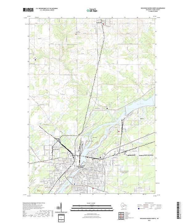
2022 Map of Wisconsin Rapids North
USGS Topo · Published 2022About this map
The Wisconsin River dominates the landscape of Wood County, anchoring the industrial and civic heart of Wisconsin Rapids. The river's path is marked by several significant landforms, including Big Island, Hunter Island, and Belle Island, which sit just downstream from the Biron Flowage. The eastern bank serves as the administrative center for the region, housing the Wood County Courthouse and the Mid - State Technical College - Wisconsin Rapids Campus.
Find a feature on this map
67 named features on this map. Tap any name to fly to it.
Don’t see what you’re looking for? This feature index may not catch every label — zoom into the map to look around manually.
Map Details
Editions of this 2022 Wisconsin Rapids North Map
This is the sole edition of this map. No revisions or reprints were ever made.
Other maps of this area

1955 · Green Bay
USGS Topo · 1:250,000

1956 · Milladore
USGS Topo · 1:48,000

1956 · Stevens Point
USGS Topo · 1:48,000

1957 · Wisconsin Rapids
USGS Topo · 1:48,000

1957 · Whiting
USGS Topo · 1:48,000

1967 · Wisconsin Rapids
USGS Topo · 1:62,500

1970 · Kellner
USGS Topo · 1:24,000

1970 · Junction City
USGS Topo · 1:24,000
1970 · Sherry
USGS Topo · 1:24,000
1970 · Rocky Run
USGS Topo · 1:24,000