
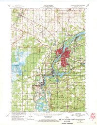
1967 Map of Wisconsin Rapids
USGS Topo · Published 1978About this map
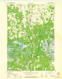
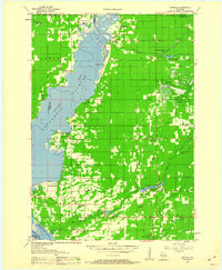
The Wisconsin River corridor defines this mid-century landscape, anchoring a series of industrial paper-milling centers including Wisconsin Rapids, Port Edwards, and Nekoosa. The river is heavily utilized, featuring several named islands like Big Island and Garrison Island, alongside man-made impoundments such as the Biron Flowage and the northern tip of Petenwell Lake. The surrounding terrain transitions from the agricultural townships of Sigel and Rudolph to the extensive Cranberry Marsh and Cranberry Bogs to the west, highlighting the region's specialized horticulture.
Find a feature on this map
79 named features on this map. Tap any name to fly to it.
Don’t see what you’re looking for? This feature index may not catch every label — zoom into the map to look around manually.
Map Details
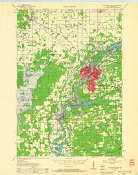
Editions of this 1967 Wisconsin Rapids Map
2 editions found
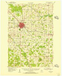
Other maps of this area

1953 · Eau Claire
USGS Topo · 1:250,000
1954 · Marshfield
USGS Topo · 1:62,500

1955 · Green Bay
USGS Topo · 1:250,000
1956 · Milladore
USGS Topo · 1:48,000

1956 · Stevens Point
USGS Topo · 1:48,000
1957 · Wisconsin Rapids
USGS Topo · 1:48,000
1957 · Pittsville
USGS Topo · 1:48,000

1957 · Whiting
USGS Topo · 1:48,000

1958 · Eau Claire
USGS Topo · 1:250,000
1958 · Arkdale
USGS Topo · 1:48,000