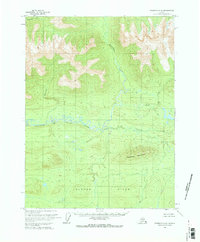
1970 Map of Wiseman A-6
USGS Topo · Published 1973About this map
The Malamute Fork Alatna River winds through this northern interior landscape, defining a complex system of wetlands and shifting watercourses. Mapped in the early 1970s, the terrain is dominated by significant elevations such as Deadman Mountain and the Alatna Hills to the south. Numerous drainage systems including Mettenpherg Creek, Roosevelt Creek, and Jones Creek flow from the surrounding highlands toward the main river valley. This survey, based on 1970 aerial photography, illustrates a wilderness area devoid of established roads or permanent settlements at the time of annotation. The map detail reflects the intricate hydrology of the region, where seasonal flooding and low-relief swamps surrounding Bedrock Creek and Cummings Creek created a challenging environment for early exploration and land management by the Bureau of Land Management.
Find a feature on this map
8 named features on this map. Tap any name to fly to it.
Don’t see what you’re looking for? This feature index may not catch every label — zoom into the map to look around manually.
Map Details
Editions of this 1970 Wiseman A-6 Map
This is the sole edition of this map. No revisions or reprints were ever made.
Other maps of this area

1951 · Hughes
USGS Topo · 1:250,000

1951 · Bettles
USGS Topo · 1:250,000

1951 · Survey Pass
USGS Topo · 1:250,000

1951 · Wiseman
USGS Topo · 1:250,000

1956 · Hughes
USGS Topo · 1:250,000

1956 · Bettles
USGS Topo · 1:250,000

1956 · Wiseman
USGS Topo · 1:250,000

1956 · Survey Pass
USGS Topo · 1:250,000

1964 · Survey Pass
USGS Topo · 1:250,000

1964 · Wiseman
USGS Topo · 1:250,000