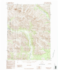
1986 Map of Wiseman B-6
USGS Topo · Published 1986About this map
Gates of the Arctic National Park and the contiguous Gates of the Arctic Wilderness dominate this high-latitude terrain, mapped from aerial photography originally captured in 1973. The landscape is defined by a dense network of drainage systems, including the southward-flowing Mettenpherg Creek and its tributaries such as Colorado Creek and Pass Creek. Along the western edge, the Fairbanks Meridian West Boundary provides a rigid cartographic line across the natural basins. This provisional survey depicts a world defined by its hydrology, where Ernie Lake sits as a primary water body in the west, while Shukok Creek and Sixtymile Creek navigate the northern slopes. The absence of roads or established trails highlights the preserved state of the Brooks Range during the mid-1980s.
Find a feature on this map
11 named features on this map. Tap any name to fly to it.
Don’t see what you’re looking for? This feature index may not catch every label — zoom into the map to look around manually.
Map Details
Editions of this 1986 Wiseman B-6 Map
This is the sole edition of this map. No revisions or reprints were ever made.
Other maps of this area

1951 · Survey Pass
USGS Topo · 1:250,000

1951 · Wiseman
USGS Topo · 1:250,000

1956 · Wiseman
USGS Topo · 1:250,000

1956 · Survey Pass
USGS Topo · 1:250,000

1964 · Survey Pass
USGS Topo · 1:250,000

1964 · Wiseman
USGS Topo · 1:250,000

1966 · Survey Pass
USGS Topo · 1:250,000
1970 · Wiseman A-6
USGS Topo · 1:63,360

1970 · Wiseman A-5
USGS Topo · 1:63,360

1971 · Wiseman C-5
USGS Topo · 1:63,360