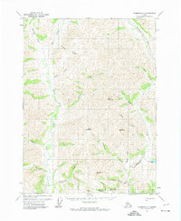
1971 Map of Wiseman C-1
USGS Topo · Published 1974About this map
The Hammond River and Glacier River dominate this interior Alaskan landscape, which was documented by the Geological Survey during the early 1970s. The region is defined by significant topographical landmarks such as Jesse Mountain, Dusty Mountain, and Vermont Dome. This particular era shows active land use in the southern portion of the sheet, where a Winter Trail provides access to the Placer Mine near Nolan Creek. Small clusters of Cabin and Cabins are situated along the lower drainages, indicating the presence of seasonal mining and hunting activity in these remote valleys. The drainage patterns of Chimney Fork and Hungry Creek provide a look at the intricate watershed systems before later 20th-century shifts in land management or climate impacted the local geography.
Find a feature on this map
31 named features on this map. Tap any name to fly to it.
Don’t see what you’re looking for? This feature index may not catch every label — zoom into the map to look around manually.
Map Details
Editions of this 1971 Wiseman C-1 Map
This is the sole edition of this map. No revisions or reprints were ever made.
Other maps of this area

1951 · Chandalar
USGS Topo · 1:250,000

1951 · Wiseman
USGS Topo · 1:250,000

1956 · Chandalar
USGS Topo · 1:250,000

1956 · Wiseman
USGS Topo · 1:250,000

1964 · Wiseman
USGS Topo · 1:250,000

1964 · Chandalar
USGS Topo · 1:250,000
1971 · Chandalar D-6
USGS Topo · 1:63,360

1971 · Wiseman C-2
USGS Topo · 1:63,360
1971 · Chandalar C-6
USGS Topo · 1:63,360
1971 · Wiseman B-1
USGS Topo · 1:63,360