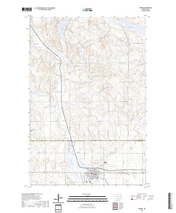
2024 Map of Wishek
USGS Topo · Published 2024About this map
Wishek serves as the central hub of this prairie landscape, where the town grid is defined by streets like Beaver Ave and 1st Ave N. The surrounding terrain in McIntosh and Logan Counties is marked by a complex network of wetlands and small water bodies, including Island Lake and Doyles Lake to the north. For those researching local heritage, several significant burial sites are documented across the plains, such as Johannesthal Cem to the west and the neighboring Saint Patricks Cem and Saint Luke Cem on the outskirts of the main settlement. The presence of the Wishek Municipal Airport highlights the area's continued reliance on regional connectivity within this agricultural corridor of North Dakota.
Find a feature on this map
31 named features on this map. Tap any name to fly to it.
Don’t see what you’re looking for? This feature index may not catch every label — zoom into the map to look around manually.
Map Details
Editions of this 2024 Wishek Map
This is the sole edition of this map. No revisions or reprints were ever made.
Other maps of this area

1953 · Jamestown
USGS Topo · 1:250,000

1956 · Jamestown
USGS Topo · 1:250,000

1982 · Wishek SW
USGS Topo · 1:24,000

1982 · Danzig
USGS Topo · 1:24,000

1982 · Wishek NE
USGS Topo · 1:24,000

1982 · May Lake NW
USGS Topo · 1:24,000

1982 · Burnstad
USGS Topo · 1:24,000

1982 · May Lake
USGS Topo · 1:24,000

1982 · Lehr NW
USGS Topo · 1:24,000

1982 · Lehr SW
USGS Topo · 1:24,000