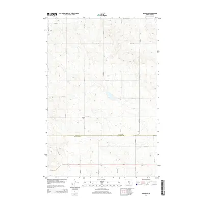
2014 Map of Wishek SW
USGS Topo · Published 2014About this map
The border between Logan Co and Mcintosh Co runs horizontally through this rural landscape, marking a transition between the northern and southern portions of this North Dakota quadrangle. The terrain is defined by undulating prairie contours and small glacial depressions, characteristic of the Drift Prairie. Cultural history is anchored by two significant burial sites: Salems Cem sits centrally along 77th St SE, while Worms Cem is located further south near 79th St SE. Transportation in the area relies on a strict section-line grid of rural roads, including 34th Ave SE and 36th Ave SE, with the paved Nd-13 cutting across the southern quadrant. This layout reflects the enduring impact of the Homestead Act on the local settlement pattern, where small family cemeteries and section-line roads remain the primary evidence of the early agrarian community.
Find a feature on this map
18 named features on this map. Tap any name to fly to it.
Don’t see what you’re looking for? This feature index may not catch every label — zoom into the map to look around manually.
Map Details
Editions of this 2014 Wishek SW Map
This is the sole edition of this map. No revisions or reprints were ever made.
Other maps of this area

1953 · Jamestown
USGS Topo · 1:250,000

1956 · Jamestown
USGS Topo · 1:250,000

1979 · Schell Buttes
USGS Topo · 1:24,000

1979 · McKenna Lake South
USGS Topo · 1:24,000

1982 · Wishek SW
USGS Topo · 1:24,000

1982 · Wishek NE
USGS Topo · 1:24,000

1982 · May Lake NW
USGS Topo · 1:24,000

1982 · Burnstad
USGS Topo · 1:24,000

1982 · May Lake
USGS Topo · 1:24,000

1982 · Wishek
USGS Topo · 1:24,000