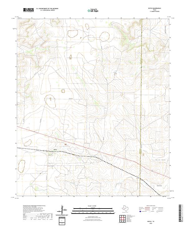
2022 Map of Witco
USGS Topo · Published 2022About this map
Witco sits at the heart of this Permian Basin landscape, where industrial utility meets the wide drainage patterns of West Texas. The settlement is defined by its proximity to energy infrastructure, evidenced by Gas Plant Rd and a network of arterial roads like Hickman Rd and Ferguson Ln. The terrain is shaped by significant ephemeral waterways, including Rock Hollow Draw, Woods Draw, and Tepee Draw, which carve subtle relief into the high plains. The boundary between Reagan and Irion counties bisects the eastern portion of the map, marking a transition in local jurisdiction. This survey captures the specialized infrastructure of a modern industrial settlement, showing how the road network, including Tom Rd and Tucker Rd, has been adapted to the demands of the local resource economy.
Find a feature on this map
14 named features on this map. Tap any name to fly to it.
Don’t see what you’re looking for? This feature index may not catch every label — zoom into the map to look around manually.
Map Details
Editions of this 2022 Witco Map
This is the sole edition of this map. No revisions or reprints were ever made.
Other maps of this area

1920 · Big Lake
USGS Topo · 1:62,500

1920 · Barnhart
USGS Topo · 1:62,500

1921 · Ketchum Mountain
USGS Topo · 1:62,500

1922 · Big Lake
USGS Topo · 1:62,500

1922 · Barnhart
USGS Topo · 1:62,500

1923 · Ketchum Mountain
USGS Topo · 1:62,500

1954 · San Angelo
USGS Topo · 1:250,000

1958 · San Angelo
USGS Topo · 1:250,000

1965 · San Angelo
USGS Topo · 1:250,000

1970 · South Mustang Draw SE
USGS Topo · 1:24,000