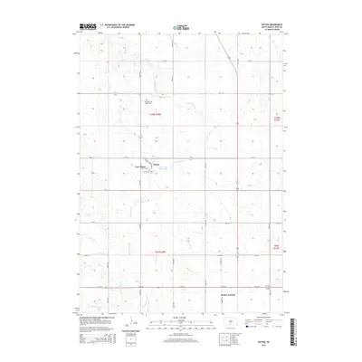
2015 Map of Witten
USGS Topo · Published 2015About this map
Witten and New Witten serve as the central hubs of this Tripp County landscape, situated where local drainage systems converge. The terrain is defined by the branching reaches of Cottonwood Cr, including its eastern and western forks, which dictate the placement of early road networks and small-scale water management like the Witten Dam Reservoir. A grid of rural section roads, such as 270th St and 271st St, provides structure to the agricultural surroundings, connecting remote landmarks to the village centers.
Find a feature on this map
23 named features on this map. Tap any name to fly to it.
Don’t see what you’re looking for? This feature index may not catch every label — zoom into the map to look around manually.
Map Details
Editions of this 2015 Witten Map
This is the sole edition of this map. No revisions or reprints were ever made.
Other maps of this area

1955 · Martin
USGS Topo · 1:250,000

1955 · Mitchell
USGS Topo · 1:250,000

1958 · Martin
USGS Topo · 1:250,000

1959 · Mitchell
USGS Topo · 1:250,000

1982 · Presho 4 SE
USGS Topo · 1:25,000

1982 · Witten SE
USGS Topo · 1:25,000

1982 · Two Nation Creek
USGS Topo · 1:25,000

1982 · Witten
USGS Topo · 1:25,000
1982 · Miller Hill
USGS Topo · 1:25,000

1982 · Witten SW
USGS Topo · 1:25,000