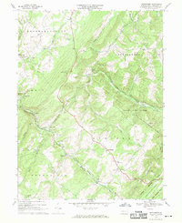
1967 Map of Wittenberg
USGS Topo · Published 1970About this map
Sand Patch and the Sand Patch Tunnel anchor this 1967 survey of the Allegheny Front, where the Baltimore and Ohio and Western Maryland railroads navigate the steep grades of Savage Mtn. The landscape is a mix of industrial transit and rural industry, evidenced by numerous small mills like Berkleys Mill and Warrens Mill, alongside active extraction at a Strip Mine and smaller Mine sites.
Find a feature on this map
50 named features on this map. Tap any name to fly to it.
Don’t see what you’re looking for? This feature index may not catch every label — zoom into the map to look around manually.
Map Details
Editions of this 1967 Wittenberg Map
4 editions found
Other maps of this area

1898 · Frostburg
USGS Topo · 1:62,500

1899 · Grantsville
USGS Topo · 1:62,500

1901 · Frostburg
USGS Topo · 1:62,500

1904 · Grantsville
USGS Topo · 1:62,500

1908 · Frostburg
USGS Topo · 1:62,500

1921 · Meyersdale
USGS Topo · 1:62,500

1923 · Berlin
USGS Topo · 1:48,000

1929 · Berlin
USGS Topo · 1:62,500

1939 · Meyersdale
USGS Topo · 1:62,500

1944 · Berlin
USGS Topo · 1:62,500
Featured Places
- Callimont, PA
- Southampton Township, PA
- Warrens Mill, Greenville Township
- Hays Mill, Brothersvalley Township
- Brothersvalley Township, PA