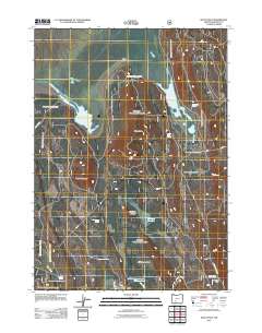
2011 Map of Wocus Bay
USGS Topo · Published 2011About this map
Wocus Bay and Little Wocus Bay define the northern hydrology of this Klamath County landscape, where the Williamson River flows through a complex of high-elevation meadows and volcanic features. This 2011 survey by the U.S. Geological Survey and U.S. Forest Service reveals a remote terrain managed for forestry and conservation, marked by a dense network of forest roads such as Kirk Rd and Nat For Dev Rd 4530. Numerous named water sources, including John Cole Spring and Wocus Butte Spring, suggest the critical importance of water management in these high flats. Prominent landmarks like Wocus Butte and Little Wocus Butte provide significant vertical relief above expansive openings like Yoss Creek Meadow and Whitehouse Flat. The presence of the Old Forest Camp indicates the area's long-standing role in forest recreation and management near the southeastern edge of the marshlands.
Find a feature on this map
21 named features on this map. Tap any name to fly to it.
Don’t see what you’re looking for? This feature index may not catch every label — zoom into the map to look around manually.
Map Details
Editions of this 2011 Wocus Bay Map
This is the sole edition of this map. No revisions or reprints were ever made.
Other maps of this area

1889 · Klamath
USGS Topo · 1:250,000

1894 · Klamath
USGS Topo · 1:250,000

1955 · Klamath Falls
USGS Topo · 1:250,000

1956 · Calimus Butte
USGS Topo · 1:62,500

1957 · Chiloquin
USGS Topo · 1:62,500

1957 · Klamath Marsh
USGS Topo · 1:62,500

1957 · Lenz
USGS Topo · 1:62,500

1958 · Klamath Falls
USGS Topo · 1:250,000

1980 · Williamson River
USGS Topo · 1:100,000
1988 · Applegate Butte
USGS Topo · 1:24,000