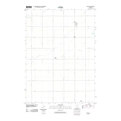
2010 Map of Woden
USGS Topo · Published 2010About this map
Woden anchors this northern Iowa landscape, appearing as a compact grid of streets in a region dominated by a precise section-line road network. The settlement's central civic life is marked by the Woden Post Office, while the surrounding rural landscape is defined by its agricultural layout and drainage. Watercourses like Buffalo Creek and Lindsey Creek meander through the townships, diverging from the rigid cardinal directions of the gravel roads.
Find a feature on this map
24 named features on this map. Tap any name to fly to it.
Don’t see what you’re looking for? This feature index may not catch every label — zoom into the map to look around manually.
Map Details
Editions of this 2010 Woden Map
This is the sole edition of this map. No revisions or reprints were ever made.
Other maps of this area

1954 · Fairmont
USGS Topo · 1:250,000

1954 · Mason City
USGS Topo · 1:250,000

1957 · Mason City
USGS Topo · 1:250,000

1958 · Mason City
USGS Topo · 1:250,000

1958 · Fairmont
USGS Topo · 1:250,000

1972 · German Valley
USGS Topo · 1:24,000

1972 · Buffalo Center SW
USGS Topo · 1:24,000

1972 · Titonka
USGS Topo · 1:24,000
1972 · Sexton
USGS Topo · 1:24,000

1972 · Crystal Lake
USGS Topo · 1:24,000