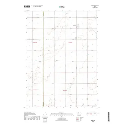
2018 Map of Woden
USGS Topo · Published 2018About this map
Woden stands as the primary settlement in this north-central Iowa landscape, positioned at the intersection of Bush Ave and 320th St. The surrounding countryside in Hancock and Kossuth Counties is defined by a precise rectilinear road grid that organizes the agricultural terrain. Several small waterways, including Buffalo Cr, Lindsey Cr, and Plum Cr, provide natural drainage through the section lines. This modern survey is a valuable resource for genealogists, as it identifies localized burial sites such as Bingham Township Cem to the south of Woden and the Christian Reformed Cem further west. In the southern portion of the quadrangle, the Orthel Township Cem serves as another focal point for local family history research within this productive prairie region.
Find a feature on this map
34 named features on this map. Tap any name to fly to it.
Don’t see what you’re looking for? This feature index may not catch every label — zoom into the map to look around manually.
Map Details
Editions of this 2018 Woden Map
This is the sole edition of this map. No revisions or reprints were ever made.
Other maps of this area

1954 · Fairmont
USGS Topo · 1:250,000

1954 · Mason City
USGS Topo · 1:250,000

1957 · Mason City
USGS Topo · 1:250,000

1958 · Mason City
USGS Topo · 1:250,000

1958 · Fairmont
USGS Topo · 1:250,000

1972 · German Valley
USGS Topo · 1:24,000

1972 · Buffalo Center SW
USGS Topo · 1:24,000

1972 · Titonka
USGS Topo · 1:24,000
1972 · Sexton
USGS Topo · 1:24,000

1972 · Crystal Lake
USGS Topo · 1:24,000