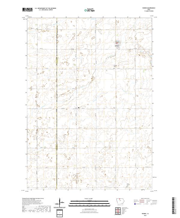
2022 Map of Woden
USGS Topo · Published 2022About this map
Woden serves as the primary hub for this agricultural portion of north-central Iowa, located where Bush Ave and Main intersect. The landscape is defined by the rigid grid of the Public Land Survey System, with the boundary between Kossuth Co and Hancock Co running vertically through the center along Ames Ave. For those tracing local family histories, three distinct burial grounds are documented: Bingham Township Cem to the south of town, Christian Reformed Cem further west, and Orthel Township Cem in the southeastern corner. Water drainage follows the subtle natural contours of the prairie via Buffalo Cr, Lindsey Cr, and Plum Cr, which deviate from the otherwise strict cardinal alignment of the township roads.
Find a feature on this map
36 named features on this map. Tap any name to fly to it.
Don’t see what you’re looking for? This feature index may not catch every label — zoom into the map to look around manually.
Map Details
Editions of this 2022 Woden Map
This is the sole edition of this map. No revisions or reprints were ever made.
Other maps of this area

1954 · Fairmont
USGS Topo · 1:250,000

1954 · Mason City
USGS Topo · 1:250,000

1957 · Mason City
USGS Topo · 1:250,000

1958 · Mason City
USGS Topo · 1:250,000

1958 · Fairmont
USGS Topo · 1:250,000

1972 · German Valley
USGS Topo · 1:24,000

1972 · Buffalo Center SW
USGS Topo · 1:24,000

1972 · Titonka
USGS Topo · 1:24,000
1972 · Sexton
USGS Topo · 1:24,000

1972 · Crystal Lake
USGS Topo · 1:24,000