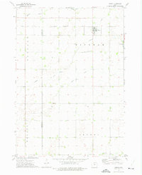
1972 Map of Woden
USGS Topo · Published 1975About this map
Woden serves as the primary hub of this North Central Iowa landscape, situated along the Chicago Rock Island and Pacific railroad. This 1972 survey illustrates the geometric precision of the Midwestern township system, with the map clearly delineating the boundaries of Bingham, Buffalo, Wesley, and Orthel townships. The drainage pattern is defined by the winding courses of Buffalo Creek, Lindsey Creek, and Plum Creek, which navigate through a patchwork of agricultural fields and occasional landmarks such as Lake George. Local heritage is anchored by sites like Woden Ch and two distinct locations of the Township Cem, reflecting the area's rural settlement pattern during the early 1970s. Industrial activity is represented by multiple locations of a Gravel Pit, pointing to local resource extraction that supported the region's road and rail infrastructure.
Find a feature on this map
14 named features on this map. Tap any name to fly to it.
Don’t see what you’re looking for? This feature index may not catch every label — zoom into the map to look around manually.
Map Details
Editions of this 1972 Woden Map
This is the sole edition of this map. No revisions or reprints were ever made.
Other maps of this area

1954 · Fairmont
USGS Topo · 1:250,000

1954 · Mason City
USGS Topo · 1:250,000

1957 · Mason City
USGS Topo · 1:250,000

1958 · Mason City
USGS Topo · 1:250,000

1958 · Fairmont
USGS Topo · 1:250,000

1972 · German Valley
USGS Topo · 1:24,000

1972 · Buffalo Center SW
USGS Topo · 1:24,000

1972 · Titonka
USGS Topo · 1:24,000
1972 · Sexton
USGS Topo · 1:24,000

1972 · Crystal Lake
USGS Topo · 1:24,000