
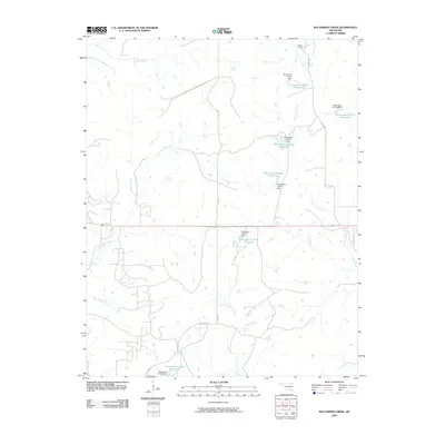
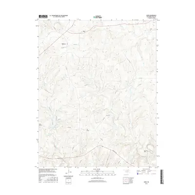
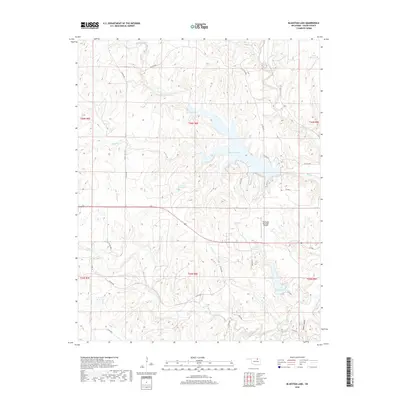
1972 Map of Wolco
USGS Topo · Published 1973About this map
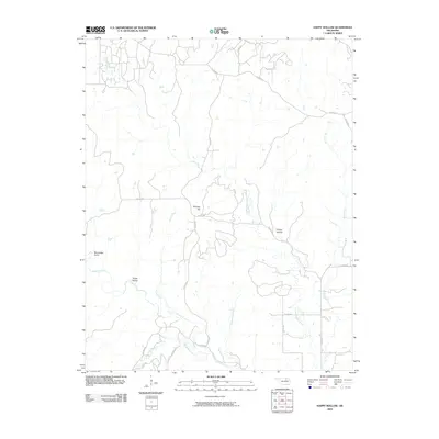
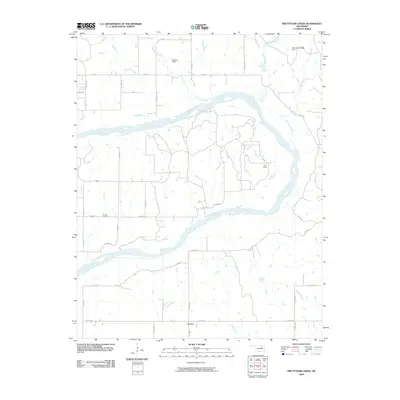
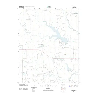
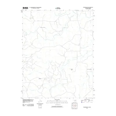
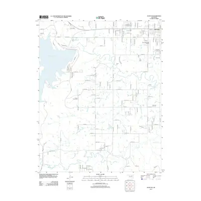
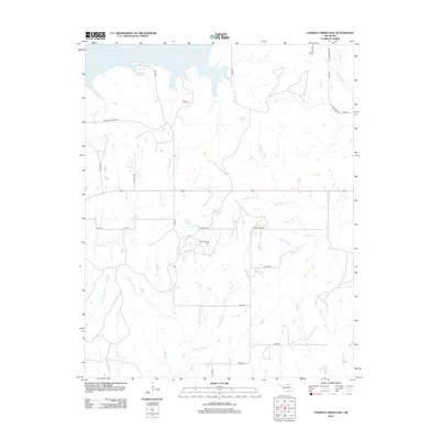
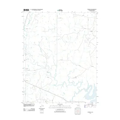
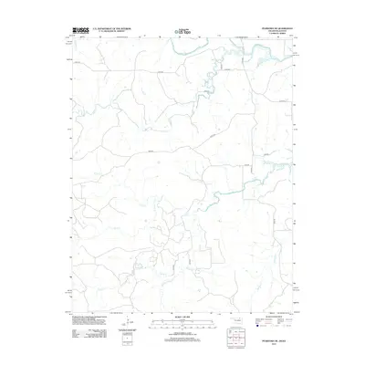
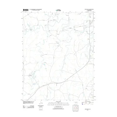
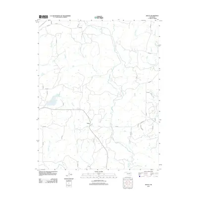
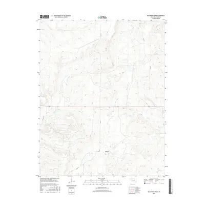
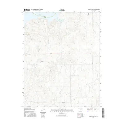
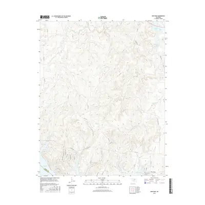
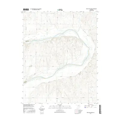
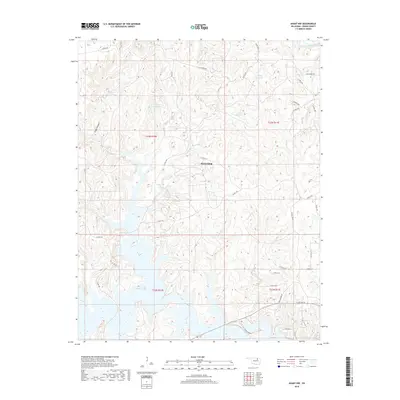
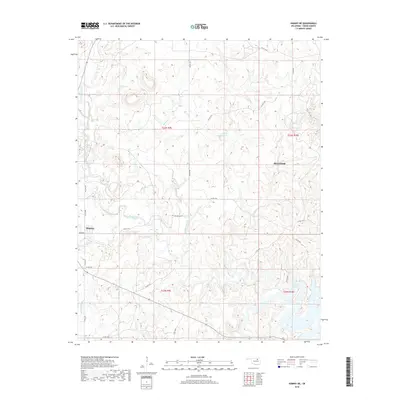
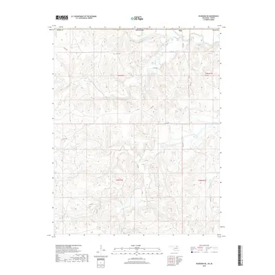
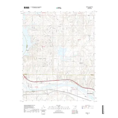
Wolco sits at the heart of this survey, surrounded by the distinctive topography of the Big Heart region. The landscape is defined by its deep involvement in the petroleum industry, evidenced by the dense concentration of Oil Wells, Gas Wells, and various Drill Holes scattered across the township lines. Along the western edge, Lake Waxhoma serves as a primary water feature, complete with a recorded Spillway Elev 748 and an adjacent Picnic Area for recreation.
Find a feature on this map
21 named features on this map. Tap any name to fly to it.
Don’t see what you’re looking for? This feature index may not catch every label — zoom into the map to look around manually.
Map Details
Editions of this 1972 Wolco Map
This is the sole edition of this map. No revisions or reprints were ever made.
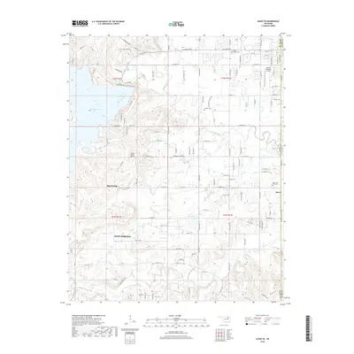
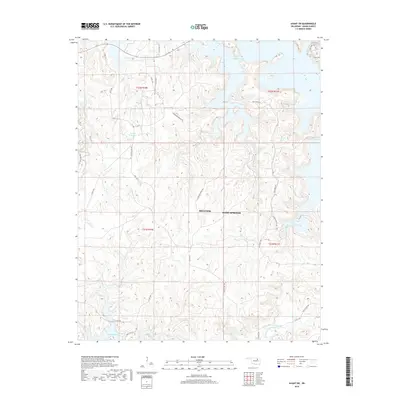
Historical Maps of Wolco Through Time
152 maps found

1936 Belford
Osage County, OK

1958 Wekiwa
Osage County, OK

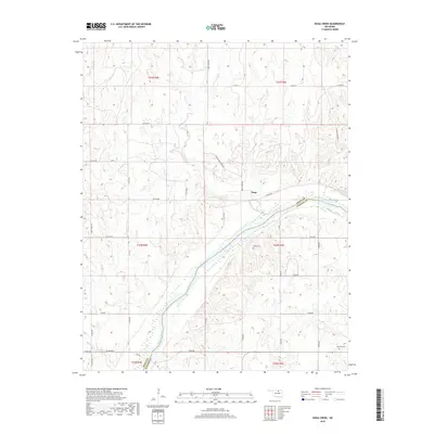
1960 Herd
Osage County, OK

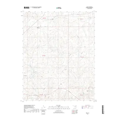
1960 Nanos
Osage County, OK

1963 Avant SE
Osage County, OK

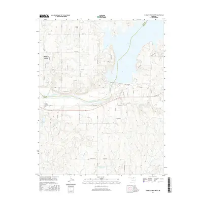
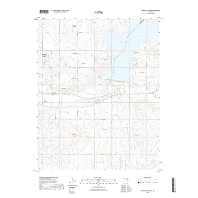
1963 Charley Creek West
Osage County, OK

1964 Charley Creek NE
Osage County, OK

1966 Avant NW
Osage County, OK

1966 Avant SW
Osage County, OK

1966 Hominy NE
Osage County, OK

1966 New Prue
Osage County, OK

1971 Bowring SE
Osage County, OK

1971 Woolaroc
Osage County, OK
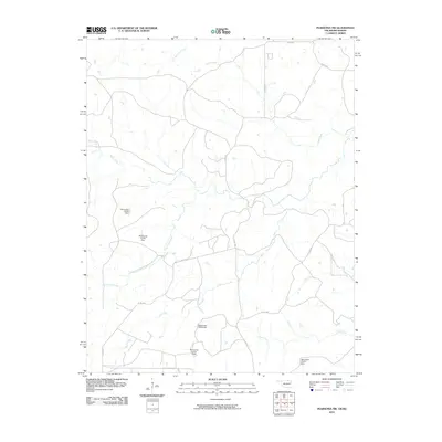
1972 Wolco
Osage County, OK

1973 Bluestem Lake
Osage County, OK

1973 Foraker North
Osage County, OK

1973 Foraker South
Osage County, OK

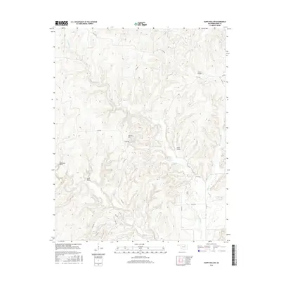
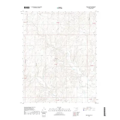
1973 Happy Hollow
Osage County, OK

1973 Pearsonia NE
Osage County, OK

1973 Pearsonia NW
Osage County, OK

1973 Pearsonia
Osage County, OK

1978 Baconrind Creek
Osage County, OK

1978 Bug Creek
Osage County, OK

1978 Doga Creek
Osage County, OK

1978 Lucy Creek
Osage County, OK

1978 Prettyhair Creek
Osage County, OK

1990 Keystone Lake
Osage County, OK
2009 Baconrind Creek
Osage County, OK
2009 Bug Creek
Osage County, OK
2009 Charley Creek East
Osage County, OK
2009 Doga Creek
Osage County, OK
2009 Happy Hollow
Osage County, OK

2009 Hominy NE
Osage County, OK
2009 Lucy Creek
Osage County, OK
2009 Nanos
Osage County, OK
2009 Pearsonia
Osage County, OK
2009 Prettyhair Creek
Osage County, OK
2010 Avant NW
Osage County, OK
2010 Avant SE
Osage County, OK
2010 Avant SW
Osage County, OK
2010 Bluestem Lake
Osage County, OK
2010 Bowring SE
Osage County, OK

2010 Charley Creek West
Osage County, OK

2010 Foraker North
Osage County, OK

2010 Foraker South
Osage County, OK
2010 Herd
Osage County, OK
2010 New Prue
Osage County, OK
2010 Pearsonia NE
Osage County, OK
2010 Pearsonia NW
Osage County, OK

2010 Wekiwa
Osage County, OK
2010 Wolco
Osage County, OK
2010 Woolaroc
Osage County, OK
2012 Avant SE
Osage County, OK
2012 Baconrind Creek
Osage County, OK
2012 Bowring SE
Osage County, OK
2012 Bug Creek
Osage County, OK
2012 Charley Creek East
Osage County, OK

2012 Charley Creek West
Osage County, OK
2012 Doga Creek
Osage County, OK

2012 Foraker North
Osage County, OK

2012 Foraker South
Osage County, OK
2012 Happy Hollow
Osage County, OK
2012 Herd
Osage County, OK
2012 Hominy NE
Osage County, OK
2012 Lucy Creek
Osage County, OK
2012 Nanos
Osage County, OK
2012 New Prue
Osage County, OK
2012 Pearsonia NE
Osage County, OK
2012 Pearsonia NW
Osage County, OK
2012 Pearsonia
Osage County, OK
2012 Prettyhair Creek
Osage County, OK

2012 Wekiwa
Osage County, OK
2012 Woolaroc
Osage County, OK
2013 Avant NW
Osage County, OK
2013 Avant SW
Osage County, OK
2013 Bluestem Lake
Osage County, OK
2013 Wolco
Osage County, OK
2016 Avant NW
Osage County, OK
2016 Avant SE
Osage County, OK
2016 Avant SW
Osage County, OK
2016 Baconrind Creek
Osage County, OK
2016 Bluestem Lake
Osage County, OK
2016 Bowring SE
Osage County, OK
2016 Bug Creek
Osage County, OK
2016 Charley Creek East
Osage County, OK
2016 Charley Creek West
Osage County, OK
2016 Doga Creek
Osage County, OK

2016 Foraker North
Osage County, OK

2016 Foraker South
Osage County, OK
2016 Happy Hollow
Osage County, OK
2016 Herd
Osage County, OK
2016 Hominy NE
Osage County, OK
2016 Lucy Creek
Osage County, OK
2016 Nanos
Osage County, OK
2016 New Prue
Osage County, OK
2016 Pearsonia NE
Osage County, OK
2016 Pearsonia NW
Osage County, OK
2016 Pearsonia
Osage County, OK
2016 Prettyhair Creek
Osage County, OK
2016 Wekiwa
Osage County, OK
2016 Wolco
Osage County, OK
2016 Woolaroc
Osage County, OK
2018 Avant NW
Osage County, OK
2018 Avant SE
Osage County, OK
2018 Avant SW
Osage County, OK
2018 Baconrind Creek
Osage County, OK
2018 Bluestem Lake
Osage County, OK
2018 Bowring SE
Osage County, OK
2018 Bug Creek
Osage County, OK
2018 Charley Creek East
Osage County, OK
2018 Charley Creek West
Osage County, OK
2018 Doga Creek
Osage County, OK

2018 Foraker North
Osage County, OK

2018 Foraker South
Osage County, OK
2018 Happy Hollow
Osage County, OK
2018 Herd
Osage County, OK
2018 Hominy NE
Osage County, OK
2018 Lucy Creek
Osage County, OK
2018 Nanos
Osage County, OK
2018 New Prue
Osage County, OK
2018 Pearsonia NE
Osage County, OK
2018 Pearsonia NW
Osage County, OK
2018 Pearsonia
Osage County, OK
2018 Prettyhair Creek
Osage County, OK
2018 Wekiwa
Osage County, OK
2018 Wolco
Osage County, OK
2018 Woolaroc
Osage County, OK

2022 Avant NW
Osage County, OK

2022 Avant SE
Osage County, OK

2022 Avant SW
Osage County, OK

2022 Baconrind Creek
Osage County, OK

2022 Bluestem Lake
Osage County, OK

2022 Bowring SE
Osage County, OK

2022 Bug Creek
Osage County, OK

2022 Charley Creek East
Osage County, OK

2022 Charley Creek West
Osage County, OK

2022 Doga Creek
Osage County, OK

2022 Foraker North
Osage County, OK

2022 Foraker South
Osage County, OK

2022 Happy Hollow
Osage County, OK

2022 Herd
Osage County, OK

2022 Hominy NE
Osage County, OK

2022 Lucy Creek
Osage County, OK

2022 Nanos
Osage County, OK

2022 New Prue
Osage County, OK

2022 Pearsonia NE
Osage County, OK

2022 Pearsonia NW
Osage County, OK

2022 Pearsonia
Osage County, OK

2022 Prettyhair Creek
Osage County, OK

2022 Wekiwa
Osage County, OK

2022 Wolco
Osage County, OK

2022 Woolaroc
Osage County, OK