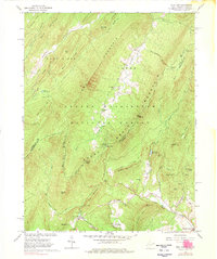
1966 Map of Wolf Gap
USGS Topo · Published 1976About this map
The industrial and recreational landscape of the West Virginia - Virginia border is captured here during the mid-1960s. The presence of Liberty Furnace, Columbia Furnace, and an Old Iron Furnace near Newman Mountain points to a history of mineral processing in the valley, while the Old Railroad Grade winding along Stony Creek reveals the transportation network that once served these operations.
Find a feature on this map
62 named features on this map. Tap any name to fly to it.
Don’t see what you’re looking for? This feature index may not catch every label — zoom into the map to look around manually.
Map Details
Editions of this 1966 Wolf Gap Map
3 editions found
Other maps of this area

1891 · Romney
USGS Topo · 1:125,000

1892 · Woodstock
USGS Topo · 1:125,000

1920 · Moorefield
USGS Topo · 1:62,500

1921 · Orkney Springs
USGS Topo · 1:48,000

1921 · Moorefield
USGS Topo · 1:48,000

1922 · Moorefield
USGS Topo · 1:62,500

1922 · Wardensville
USGS Topo · 1:62,500

1923 · Orkney Springs
USGS Topo · 1:62,500

1923 · Edinburg
USGS Topo · 1:62,500

1924 · Wardensville
USGS Topo · 1:62,500