
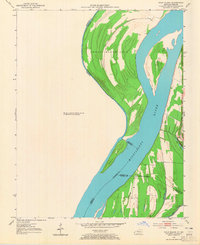
1951 Map of Wolf Island
USGS Topo · Published 1953About this map
The Mississippi River dominates this mid-century survey, defining a complex borderland where Kentucky, Missouri, and Illinois converge. This specific reach is characterized by massive shifting landforms like Wolf Island No 5 and the prominent Middle Bar. The topography reveals the river's dynamic nature through a series of secondary waterways and depressions, including Three Ponds Slough and Long Pond, which mark the low-lying floodplain south of Chalk Bluff.
Find a feature on this map
16 named features on this map. Tap any name to fly to it.
Don’t see what you’re looking for? This feature index may not catch every label — zoom into the map to look around manually.
Map Details
Editions of this 1951 Wolf Island Map
2 editions found
Other maps of this area

1939 · Wickliffe
USGS Topo · 1:62,500

1939 · Charleston
USGS Topo · 1:62,500

1939 · Hickman
USGS Topo · 1:62,500

1939 · Bayouville
USGS Topo · 1:62,500

1951 · Cayce
USGS Topo · 1:24,000

1951 · Bondurant
USGS Topo · 1:24,000

1951 · Oakton
USGS Topo · 1:24,000

1951 · Hickman
USGS Topo · 1:24,000

1951 · Wickliffe SW
USGS Topo · 1:24,000

1951 · Arlington
USGS Topo · 1:24,000