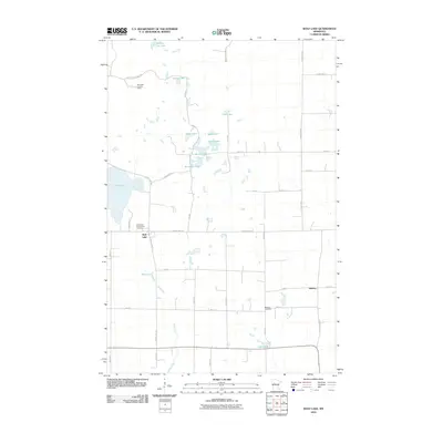
2010 Map of Wolf Lake
USGS Topo · Published 2010About this map
Wolf Lake and its surrounding wetlands define this Becker County landscape, where the Kettle River meanders through a dense network of glacial lakes and marshy basins. The small settlement of Midway sits at the eastern edge of a grid system that connects rural homesteads via routes like County Hwy 40 and County Hwy 47. Significant local landmarks provide essential navigation and community history, including the Wolf Lake Lookout Tower overlooking the northern woods and two local burial grounds, Wolf Lake Community Cemetery and Bethany Cemetery. The geography is remarkably saturated with water bodies, from the larger span of Wolf Lake to smaller basins such as Section Ten Lake, Island Lake, and Mud Lake. This layout illustrates a post-millennium rural Minnesota community where historical local road names like Wolf Pack Rd and E Town Hall Rd persist alongside modern surveying coordinates.
Find a feature on this map
42 named features on this map. Tap any name to fly to it.
Don’t see what you’re looking for? This feature index may not catch every label — zoom into the map to look around manually.
Map Details
Editions of this 2010 Wolf Lake Map
This is the sole edition of this map. No revisions or reprints were ever made.
Other maps of this area

1953 · Brainerd
USGS Topo · 1:250,000

1957 · Brainerd
USGS Topo · 1:250,000

1958 · Brainerd
USGS Topo · 1:250,000

1965 · Brainerd
USGS Topo · 1:250,000

1969 · Wolf Lake
USGS Topo · 1:24,000

1969 · Evergreen
USGS Topo · 1:24,000

1969 · Park Rapids SW
USGS Topo · 1:24,000

1969 · New York Mills NW
USGS Topo · 1:24,000

1969 · Sebeka NW
USGS Topo · 1:24,000
1969 · Ponsford
USGS Topo · 1:24,000