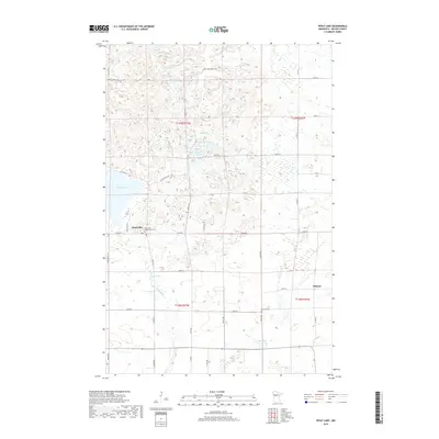
2019 Map of Wolf Lake
USGS Topo · Published 2019About this map
Wolf Lake and its surrounding wetlands and waterways define this portion of Becker County in the late 2010s. The settlement of Wolf Lake is the primary hub, situated near the Wolf Lake Community Cemetery and served by County Highway 38 and County Road 40. The landscape is a complex glacial terrain characterized by numerous small, distinct water bodies such as Spot Lake, Island Lake, and Section Ten Lake. To the southeast, the small community of Midway lies near the Kettle River, which drains through the southern sections of the quadrangle. Genealogical interest is centered on the local burial grounds, including Bethany Cemetery, which provides a geographical anchor for family researchers in these rural townships. The map illustrates a contemporary road network of avenues and streets, including 510th Avenue and 140th Street, that follow the established section lines of the Public Land Survey System.
Find a feature on this map
45 named features on this map. Tap any name to fly to it.
Don’t see what you’re looking for? This feature index may not catch every label — zoom into the map to look around manually.
Map Details
Editions of this 2019 Wolf Lake Map
This is the sole edition of this map. No revisions or reprints were ever made.
Other maps of this area

1953 · Brainerd
USGS Topo · 1:250,000

1957 · Brainerd
USGS Topo · 1:250,000

1958 · Brainerd
USGS Topo · 1:250,000

1965 · Brainerd
USGS Topo · 1:250,000

1969 · Wolf Lake
USGS Topo · 1:24,000

1969 · Evergreen
USGS Topo · 1:24,000

1969 · Park Rapids SW
USGS Topo · 1:24,000

1969 · New York Mills NW
USGS Topo · 1:24,000

1969 · Sebeka NW
USGS Topo · 1:24,000
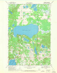
1969 · Ponsford
USGS Topo · 1:24,000